Community Environment Government Transportation
County seeking comments on Fox Island Bridge replacement
Pierce County invites the public to participate in the first step of a long and complicated environmental review process for a new Fox Island bridge.
The project requires a State Environmental Policy Act (SEPA) process and an Environmental Impact Statement (EIS). Because the county determined the bridge replacement will likely cause significant adverse environmental impacts, SEPA requires it to issue a Determination of Significance (DS). A DS provides notification that an EIS will be prepared and identifies elements of the environment and alternatives to be studied in the EIS.
Determination of Significance issued Aug. 4
The county issued a Determination of Significance on Aug. 4. People can submit comments on it during two in-person sessions at Nichols Center on Fox Island — from 9 a.m. to noon Aug. 19 and from 3 to 6 p.m. Aug. 20. Comments can also be left online using this form during the month of August.
An EIS examines significant environmental impacts and informs decision-makers and the public of reasonable alternatives, including mitigation measures, that would avoid or minimize adverse impacts or enhance environmental quality.
It allows government agencies and residents to review and comment on the proposal. Information it contains will be considered before permits and decisions are rendered. An EIS process comprises a draft (DEIS) and a final (FEIS).
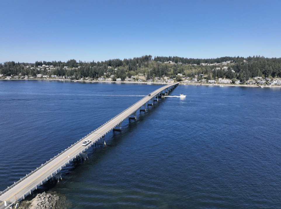
The Fox Island bridge crosses Hales Passage between Fox Island and the Gig Harbor mainland. Photo courtesy of Pierce County
The county hired design and engineering firm HDR in early 2024 to perform a Type, Size and Location Study. The consultants and county held an open house in August 2024 to receive input on myriad replacement options for the 1954 bridge and another in April on three surviving alternatives.
Three remaining alternatives
They are a 2,000-foot bridge just east of the current 1,950-footer, a 2,000-foot bridge alongside the west of it and a 3,000-foot bridge that arches out farther to the west, around the boat ramp.
All would be 42 feet wide with two 11-foot car lanes, 4-foot shoulders and a separated 12-foot pedestrian/bicycle path. Cost estimates are $209 to $217 million for the shorter bridges and $254 to 257 million for the longer one. The 2,000-footers would use the existing causeway on the island side while the 3,000-footer would go around the boat launch and make landfall west of it.
Construction could begin in 2030, if environmental permitting, design and funding go smoothly.
The county expects the study to be completed by the end of the year with determination of the final alternative.