Arts & Entertainment Community
Day Tripper | On the waterfront (the end, probably)
We’ve visited the new and vastly improved Seattle waterfront several times before.
Our first visit was just after the opening of the new Overlook Walk Park. Extending from Pier 52 (AKA Colman Dock, the Seattle ferry terminal) to the Aquarium on Pier 59, the area serves as our front door when approaching Seattle by water.
We went back the next month to check out how all the improvements connect Pike Place Market to the Overlook Walk and the waterfront, creating a seamless accessible transition from one elevation to another.
Even more new attractions
But that was a year ago. The past year has seen the official conclusion of this massive redevelopment project and resulted in additional changes that warranted a third, and most likely final, visit.
Several additional attractions on the waterfront opened this year. First, there’s new and somewhat improved access from the ferry terminal to Pioneer Square, particularly if you’re traveling by foot. The city of Seattle replaced the old footbridge from the ferry, allowing visitors to transition to the stadiums on foot.
Second, work has been completed in the recreational area around Piers 58 and 62. This area opened to much fanfare in early September. Nine new art installations line the waterfront, as well as two new play areas. There’s even a new public restroom. It certainly felt like this month, the first anniversary of the introduction of the project to the public, would be a great time for a follow-up visit.
I decided to do something a bit different this trip and approach Seattle by ferry. That’s not the way to travel if you’re in a hurry, but if the freeway’s a mess (and when isn’t it), it can be a bit less stressful, albeit a lot more expensive.
Getting to Bremerton from Gig Harbor takes about 35 minutes, and then there’s an hour ferry ride. Even if everything goes smoothly, that takes longer than driving, which on a good day is only 45 minutes from Gig Harbor. Add in the time spent waiting for the ferry once you arrive at the terminal, and it could very well double your transit time.
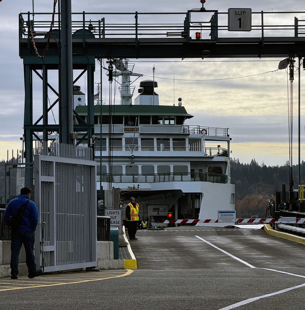
The Washington State Ferry Chimacum arrives in Bremerton. Photo by Mary Williams
A faster ferry option
There’s a third option which I plan to investigate this year.
Kitsap Transit runs fast passenger-only ferries from several Kitsap County locations to the Seattle terminal. The fast ferry that leaves from Southworth arrives in Seattle about a half-hour after it leaves the dock and delivers passengers to the downtown area rather than West Seattle, as the state ferry from Southworth does.
I certainly can’t claim to be a regular ferry rider. It’s probably been the better part of a decade since I took the ferry from Bremerton to Seattle. If I do travel by ferry, its usually at the end of the day, when I’m trying to avoid rush-hour traffic. I don’t think I’ve ever made the trip on foot.
Having arrived in Seattle and parked (not the easiest thing to do at this end of the waterfront) I walked back to the terminal to check out all the claims made in the city’s promotional materials. For the most part, they’re not wrong.
The ferry terminal is spacious, clean, and seems to be adequately staffed. Several art installations add texture to the surroundings, and the view of Elliott Bay through the wall of glass windows is spectacular.
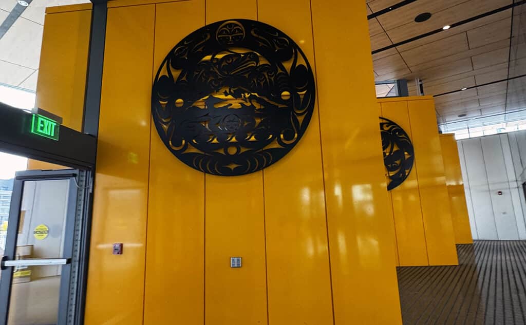
Artwork inside Colman Dock, the Washington State Ferries terminal in Seattle. Photo by Mary Williams
An open plaza on the second level leads from the waiting room to stairs, ramps, or an elevator to Alaskan Way. It also provides access to the overpass and walkway leading to Pioneer Square. One of the two new play structures is near the walkway on street level. Several giant swings look like they’d be a lot of fun.
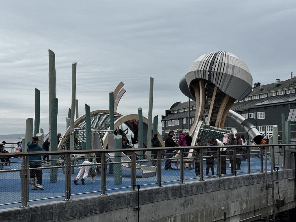
One of the new playgrounds along the Seattle waterfront. Photo by Mary Williams
Pioneer Square
The city claims that what was once a difficult walk through a questionable neighborhood has been made much easier. A new pedestrian bridge leading from the terminal to Pioneer Square is said to facilitate safe access.
I can, of course, only speak for myself, and share my experience on the day I visited. Perhaps had I been traveling when there were a lot of tourists, or if I were in the company of a large group traveling to a game, I would have felt much differently, but I visited in the early afternoon on a quiet weekday. I usually enjoy exploring alone, but this experience felt a bit dicey.
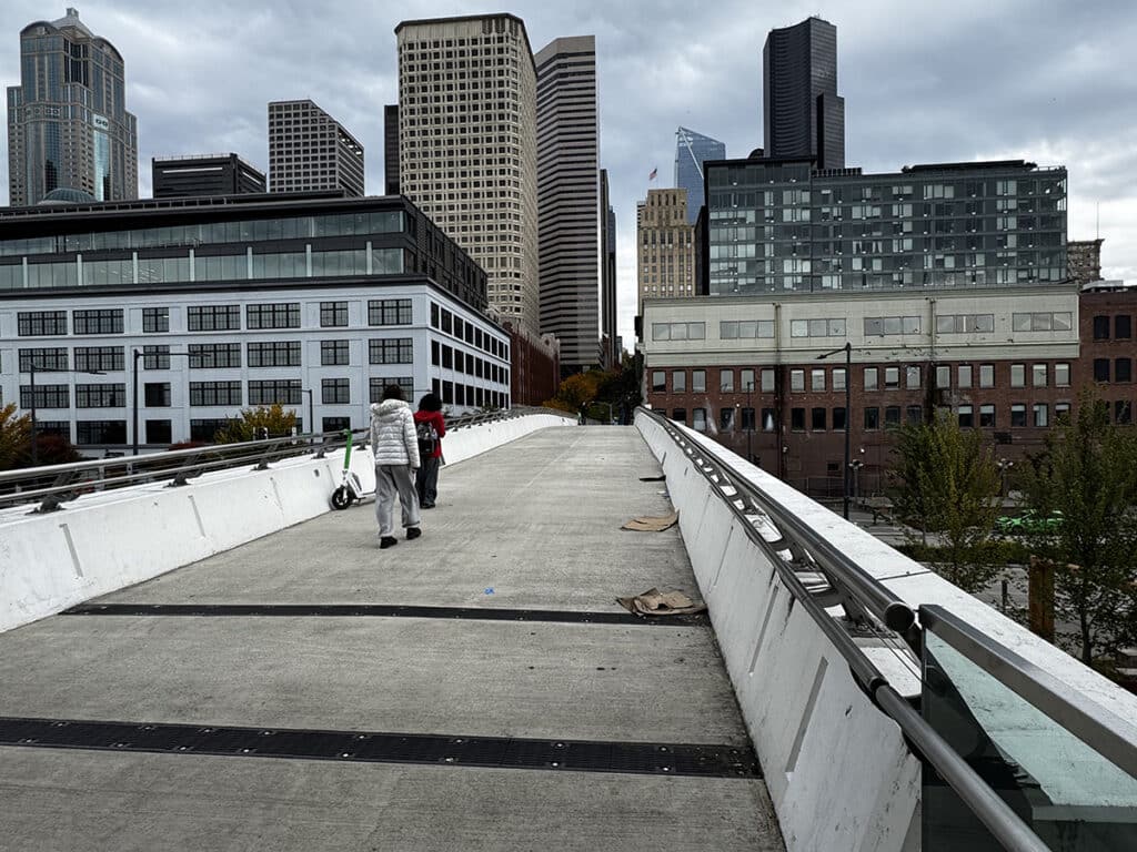
The rebuilt footbridge connecting Colman Dock to Pioneer Square. Photo by Mary Williams
While I didn’t see a homeless contingent or observe any drug use or paraphernalia, I just didn’t feel safe. I felt like I needed to be looking over my shoulder rather than at the scenery around me.
I’m always looking for new adventures, but since being mugged is not one I’m interested in, I decided it would be best to retrieve my recently parked car and devise a Plan B. If I was still going to investigate the rest of Pioneer Square and Sodo, I was going to have to do it more securely.
One advantage of traveling on foot is that you notice things you probably would not see from a car or in traffic. One of those areas is Pioneer Square Habitat Beach, just south of the terminal. Back in the touristy confines of the actual waterfront, I was feeling a bit better, so I decided that before I left the area I should check out the little beach I’d read about.
Habitat Beach
At only 200 feet long, Pioneer Square Habitat Beach is one of the smallest urban beaches in the area. An art installation on the nearby boardwalk doubles as a seating area. The public artwork, Migration Stage, by Buster Simpson, is both a scenic spot and a cultural landmark.
Habitat Beach is a newly constructed, man-made beach providing a place to sit and enjoy the view. It was designed to support the waterfront ecosystem through the addition of rocks and appropriate vegetation. Whether you’re there to relax a little, meditate, or just have lunch, it’s apt to generate a feeling of serenity. The beach is open daily from 7 a.m. to 10 p.m.
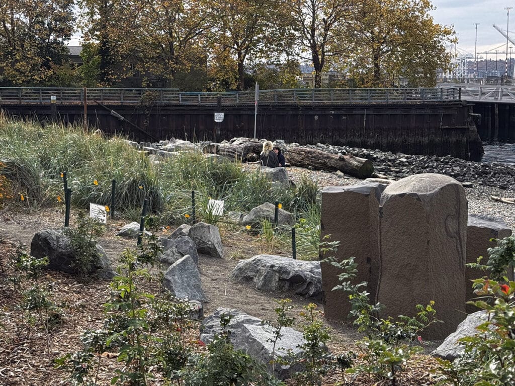
Habitat Beach in Seattle. Photo by Mary Williams
After a few minutes of deep breathing, and now in a freshly Zen state, I decided to try rolling with the punches. Flexibility is not always my strong suit, but I decided it was easy enough to grab my car, relocate to the middle of Pioneer Square and the Stadium District, and carry on with my day. I didn’t need to abandon my plans, just revise them a little.
History of the square
Pioneer Square is said to be one of the best surviving collections of Romanesque Revival style urban architecture in America. It’s Seattle’s original downtown, built in 1852 and then rebuilt following the great fire of 1889, which destroyed 25 city blocks. Seattle’s underground (yet another place to explore someday) was created when the flood-prone area was rebuilt using only stone and brick. When, shortly after the turn of the century, businesses began to move north toward the current downtown region, Pioneer Square became a honky-tonk district of taverns and seedy hotels.
In the 1960s, the city considered a plan to build a ring road around the downtown area which would have required that many of the historic buildings be leveled. Fortunately, architects Ralph Anderson and Victor Steinbruek stepped in, creating an inventory of buildings and documenting their architectural significance.
Preservationists, citizens, and city officials realized the historical significance of the area and took steps to preserve it. It became a National Historic District as well as Seattle’s first historic preservation district in 1970. The 88-acre area is now protected by ordinance and design guidelines that focus on preserving its architectural character.
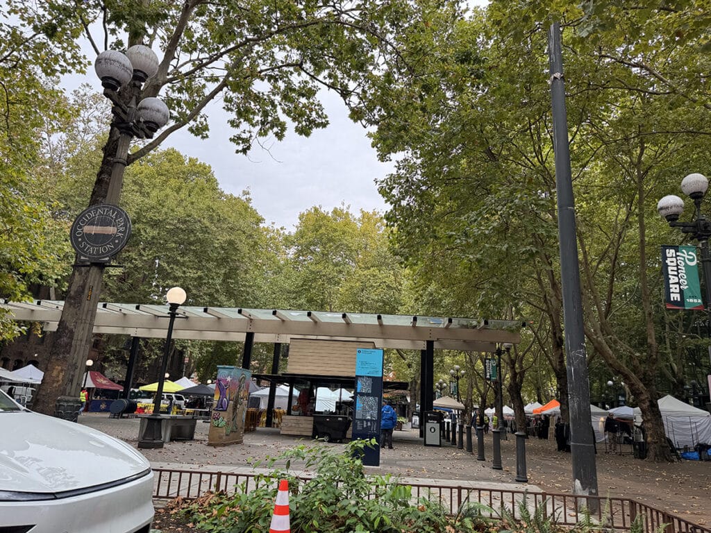
Occidental Park in Seattle’s Pioneer Square. Photo by Mary Williams
Today, the square is an eclectic combination of entertainment, shopping and arts venues. There is also a significant residential component. Lots of things will be going on there over the upcoming holiday season, but so far only a few of them have been announced. The park will host live music on Dec. 4, 11, and 18. On Wednesdays in December, check out the music provided by the Dickens Carolers and the Seattle Jazz Fellowship. For more information, or to see what else is happening, visit https://pioneersquare.org/events/.
Cadillac Hotel
One of the places you should be sure to visit is the Seattle unit of the Klondike Gold Rush National Park Historic Museum. Located at 319 2nd Ave S., the museum is housed in the old Cadillac Hotel at the corner of South Jackson Street and Second Avenue South.
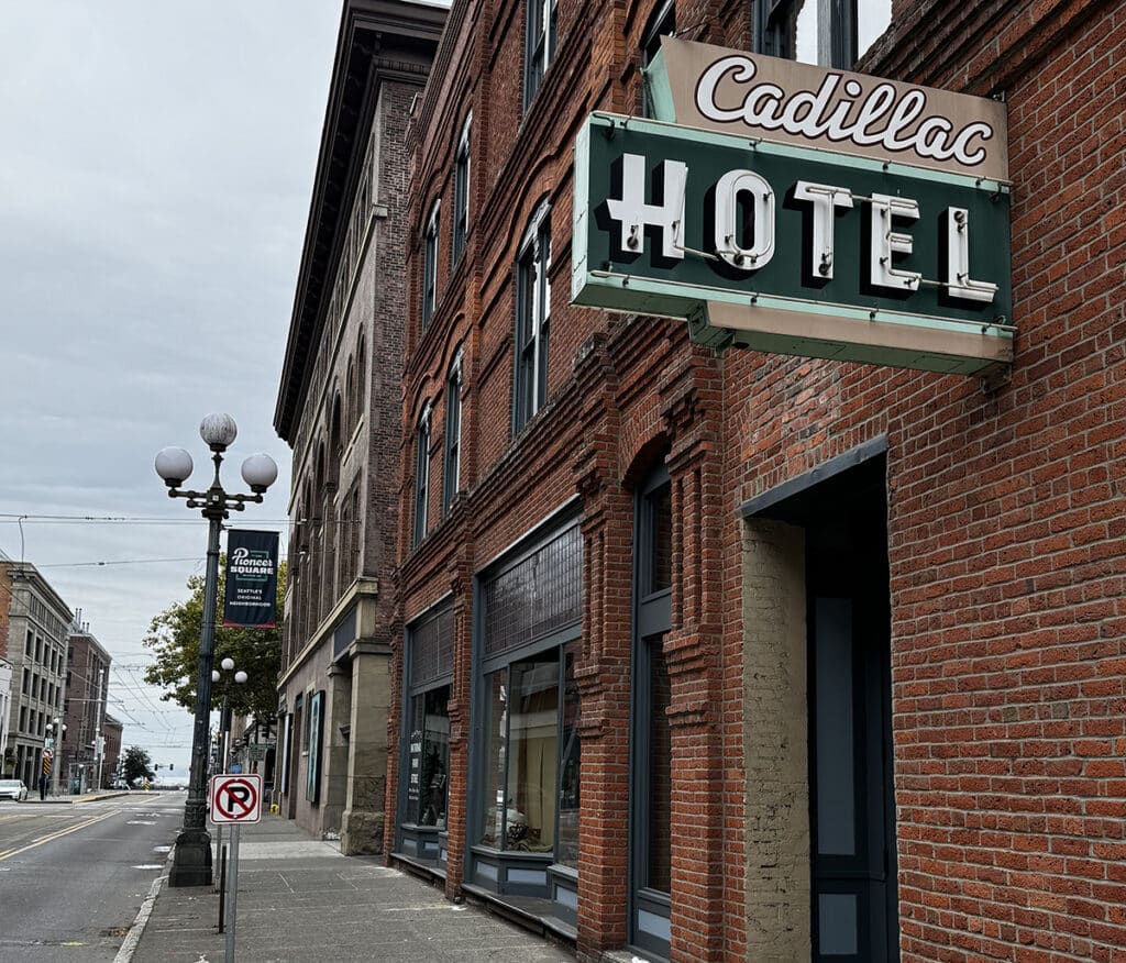
The former Cadillac Hotel is the site of the Klondike Gold Rush National Park Historic Museum. Photo by Mary Williams
The discovery of gold in the Alaskan Klondike turned Seattle into a rest stop on the road many hoped would lead to fortune. If you’re looking for a brief history of early Western settlers in Seattle and the impact of the gold rush on the fledgling community, check out the National Park Service Gold Rush Museum website.
Some people apparently decided this level of adventure was not for them and stayed in Seattle to make their fortunes in other ways. One of them was John W. Nordstrom, who established the first Nordstrom department store. The museum tells their story and explains the impact the gold rush had on the city.
The park has a sister in Skagway, Alaska: Klondike Gold Rush National Historical Park – Alaska. Admission is free, or will be once the park reopens. At the time of this writing, both parks are victims of the government shutdown and are closed indefinitely.
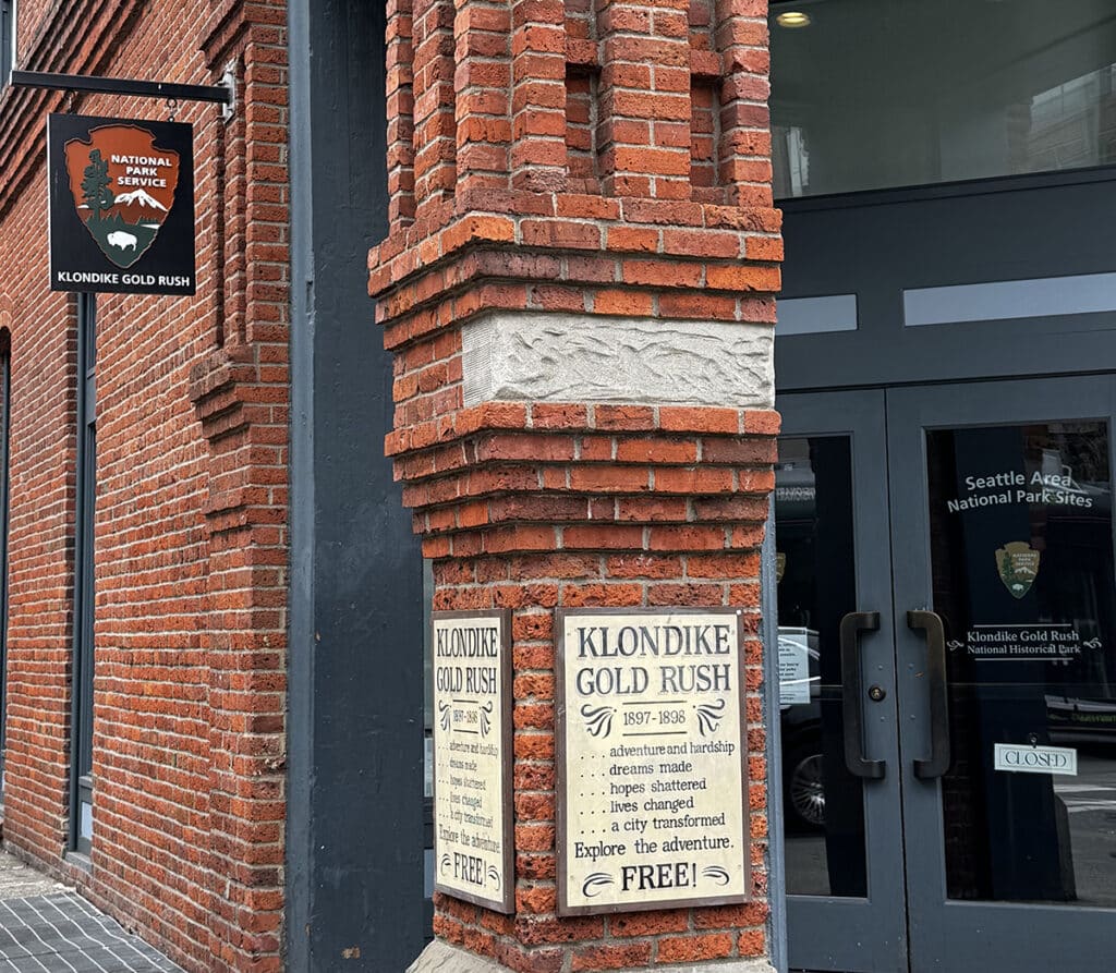
The museum will open again some day, most likely. Photo by Mary Williams
Trail to Treasure
When (if?) the government re-opens, look for the Park Service’s Trail to Treasure brochure, which is a self-paced walking tour of Pioneer Square.
Starting at the park, the Trail to Treasure map identifies special places and events that helped shape the history and development of Pioneer Square. The tour is designed so you can jump in at any point. Guided tours are also available, or will be again in the future.
Since I was feeling less paranoid and more comfortable, I decided to walk the couple of blocks down Second Avenue South to Lumen Field and T-Mobile Park. Thankfully, the stadiums aren’t affected by government shutdowns, just season-ending loses (I’m not bitter. Really, I’m not!).
Stadium District
First up is Lumen Field, home of the Seahawks, Sounders, and Reign FC. The Lumen Field stadium complex includes Lumen Field, Lumen Field Event Center and WAMU Theater. The stadium complex hosts many other events such as the annual Home Show and Auto Show, Monster Jam, Supercross, and a plethora of concerts. Next summer, it will be a host venue for the 2026 FIFA World Cup.
The $430 million facility is owned by the public and was funded by a private-public partnership. Private contributions totaling at least $130 million helped with construction costs, while the public contributed up to $300 million.
The venue will host the Boat Show, the Home and Garden Show, and the RV Show in January, February, and March 2026 respectively. For a complete listing of upcoming events, check out Lumen Field’s website.
Just south of Lumen Field is our final stop at this end of our exploration. T-Mobile Park is the home of the Seattle Mariners. The north end of the stadium is just across the street from WAMU Theater.
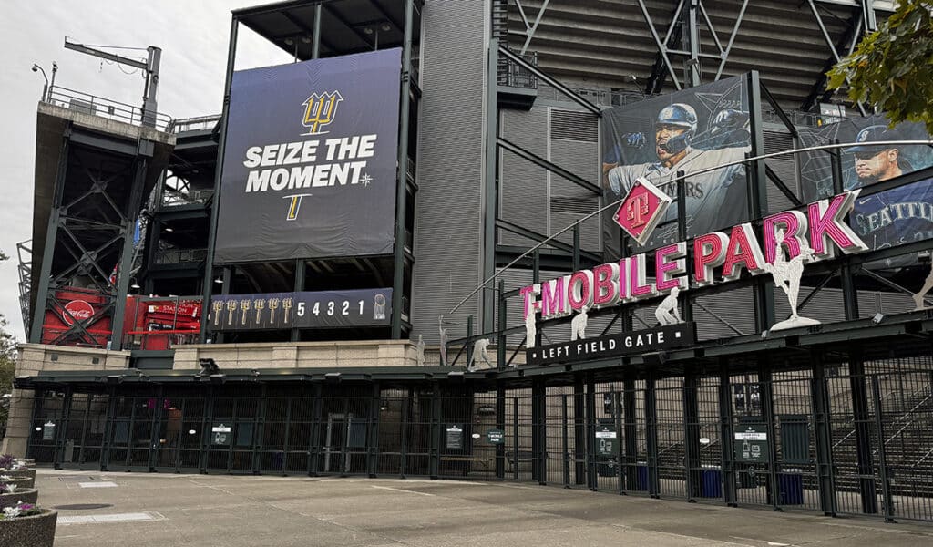
T-Mobile Park, home of the American League West champion Seattle Mariners. Photo by Mary Williams
Edgar and Dave
The main entrance to T-Mobile Park is easy to find because it’s located at the corner of Edgar and Dave.
Two streets — one named for longtime Mariner superstar and Hall of Famer Edgar Martinez, the other for Hall of Fame broadcaster Dave Niehaus — border the stadium.
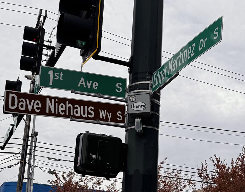
The corner of Edgar and Dave. Photo by Mary Williams
The state-of-the-art ballpark officially opened on July 15, 1999, after more than five years of planning and construction. A full house was there when the M’s met the San Diego Padres on a beautiful day with the roof wide open.
The roof covers approximately 9 acres and weighs 22 million pounds. 128 wheels move it along rails on the north and south sides of the ballpark. The top of the roof is 269 feet above the field, while the bottom is 217 feet high. It takes 10 to 20 minutes to open it. Contrary to popular belief, it’s usually moved to allow rain in, not keep it out. The Mariners play only 17 or 18 games each season with the roof closed.
If you want to learn more about the stadium, 75-minute walking tours are available. Tours are also available on game days, but you won’t be able to see the M’s at home again until April. You can buy tour tickets online at Ticketmaster, but they are not available at the T-Mobile Park Box Office or Team Store. For more information about tours, visit the website.
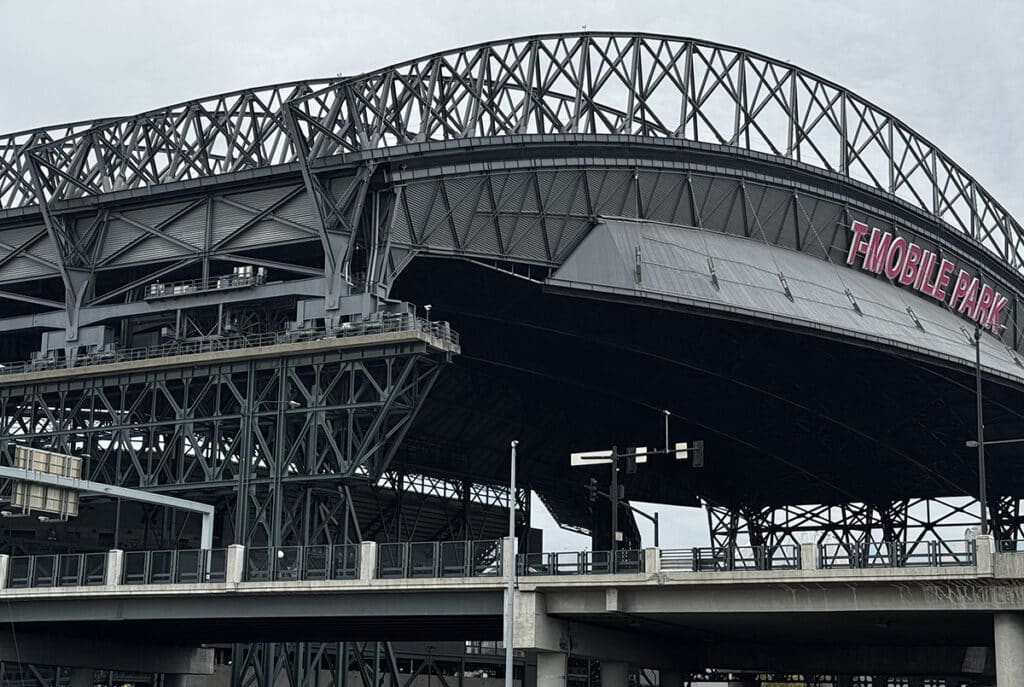
The roof on T-Mobile Stadium is almost always open for games. Photo by Mary Williams
Art + sports
I had no idea there was so much public art at the stadium. I guess I’m usually more focused on what’s happening on the field than under my feet or over my head. At some point, I think I’d like to go back and take a tour just so I will focus on more than the game and food. It looks like there’s a whole lot to see. Some of the things I’d like to check out are:
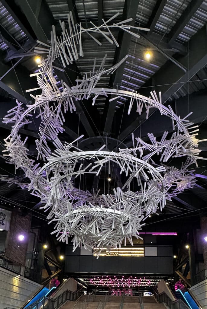
The Tempest at T-Mobile Park. Photo by Mary Williams
- “The Tempest,” a chandelier made of 1,000 resin baseball bats above the home plate entrance. It hovers over a 27-foot diameter compass rose mosaic at the home plate rotunda.
- “Quilts” depicting each MLB team logo, made from recycled metal.
- Six Pitches, a series of metal sculptures depicting hands gripping baseballs for various types of pitches along the west facade of the garage.
- A 9-foot-tall bronze baseball glove, The Mitt, by Gerald Tsutakawa.
- I’ve seen the bronze statue of Dave Niehaus several times. It’s located on the main level of the stadium. Dave broadcast 5,284 Mariners games over 34 seasons.
- In April 2017, sculptor Lou Cella unveiled a statue of Ken Griffey Jr. outside the main entrance to the ballpark. Just up the street is a bronze statue of Edgar Martínez, also by Cella. A statue of Ichiro will be unveiled in 2026.
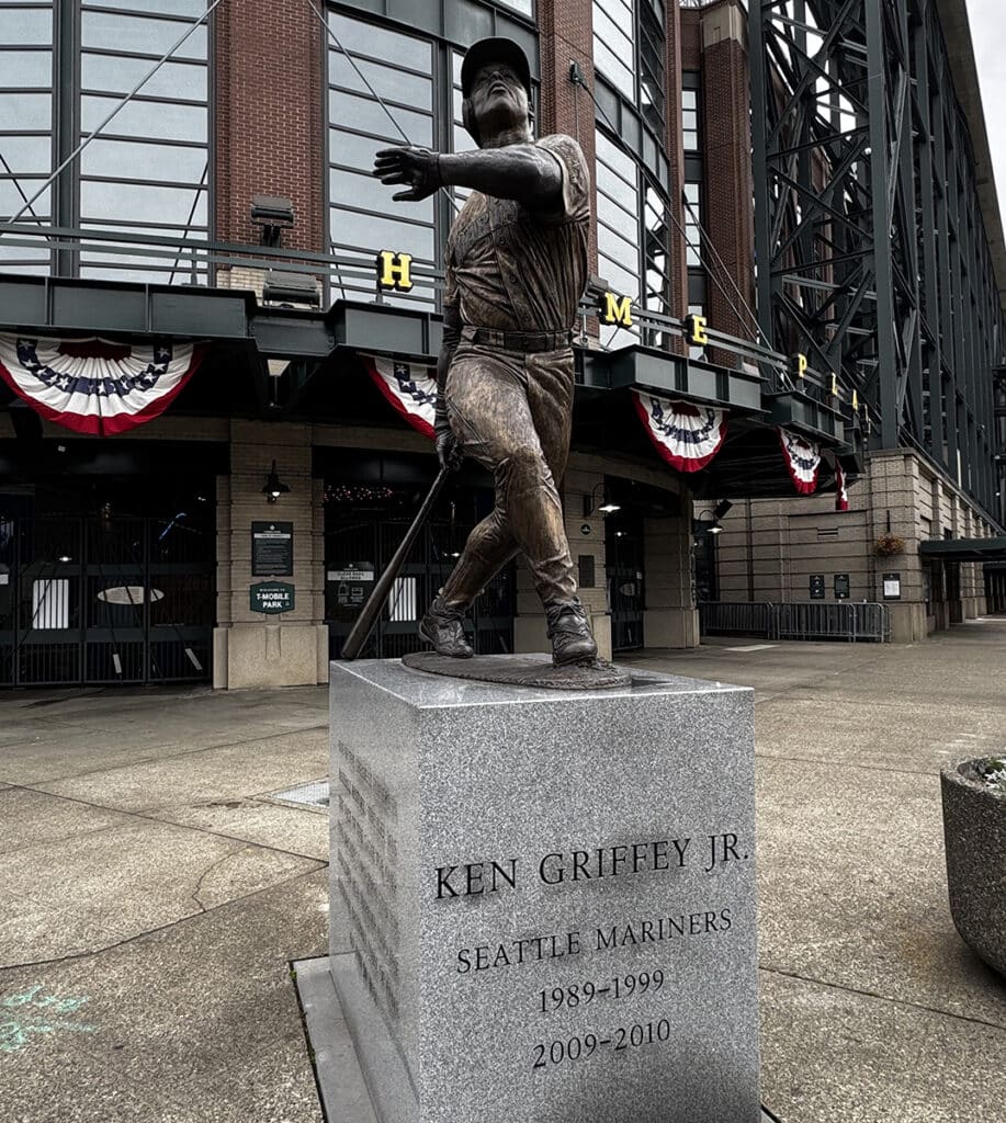
A sculpture of Mariners legend Ken Griffey Jr. outside T-Mobile Stadium. Photo by Mary Williams
Piers 58 and 62
Now that we’ve checked out the southern end of the waterfront, it’s time to complete our tour with a visit to the newly opened Piers 58 and 62, just 1.3 miles down Alaskan Way.
A grand opening celebration for Piers 58 and 62 was Sept. 6. Some of the attractions unveiled that day were:
- A biker on the path underneath Oscar Tuazon’s “To Our Teachers deqʷaled (Houseposts),” one of the new permanent artworks on the waterfront.
- A play area on Pier 58 featuring a 25-foot jellyfish-inspired climbing structure.
- A bronze historic FitzGerald fountain that was restored and reinstalled on Pier 58.
- A wood sculpture entitled Family by Qwalsius-Shawn Peterson
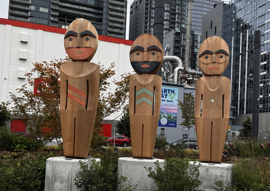
Family, a sculpture on the Seattle waterfront. Photo by Mary Williams
Pier 62 hosted many concerts and events over the years. In June 2020, the city completed the major construction elements of a rebuild using 175 steel piles and 214 new concrete deck panels. The result was an additional 40,000 square feet of park space.
This year, infrastructure improvements made it a more friendly space. It is now a flexible park with views of Elliott Bay, the Olympics and the Seattle skyline.
With the health and welfare of our local salmon and marine life in mind, another part of the project was removal of Pier 63, next to Pier 62. The removal of Pier 63 improved the nearshore habitat by removing nearly 50,000 square feet of decking and 894 timber piles that were casting a shadow over the marine habitat below.
Emerald City jewel
Now that we’ve visited the waterfront from SoDo to the Pike Place Market and Aquarium, sometimes on several occasions, I can only conclude that this is a prime example of the old axiom about the whole being greater than the sum of its parts. There really is something for everyone.
The removal of the viaduct and subsequent renovations have brought forth a sparkling area fit for an Emerald City.
About the Day Tripper column
Gas prices are sky high, and a night in a hotel is approaching astronomically expensive. So, for the foreseeable future, I imagine many of you are going to find yourselves taking day trips rather than the road trip vacations we’ve grown to love.
This beautiful region in which we live is ripe with opportunities to explore new places, see new things, and learn a little something at the same time. I promise to keep the longest journeys to a one-way distance of under 200 miles. Whether you want to make it an overnight trip, a weekend, or just a very long day trip, we should be able to pull it off.
I hope you’ll grant me the honor of your virtual company as we travel these roads together. Happy trails!
