Arts & Entertainment Community Environment
Two In Tow & On The Go | A South Creek Mystery

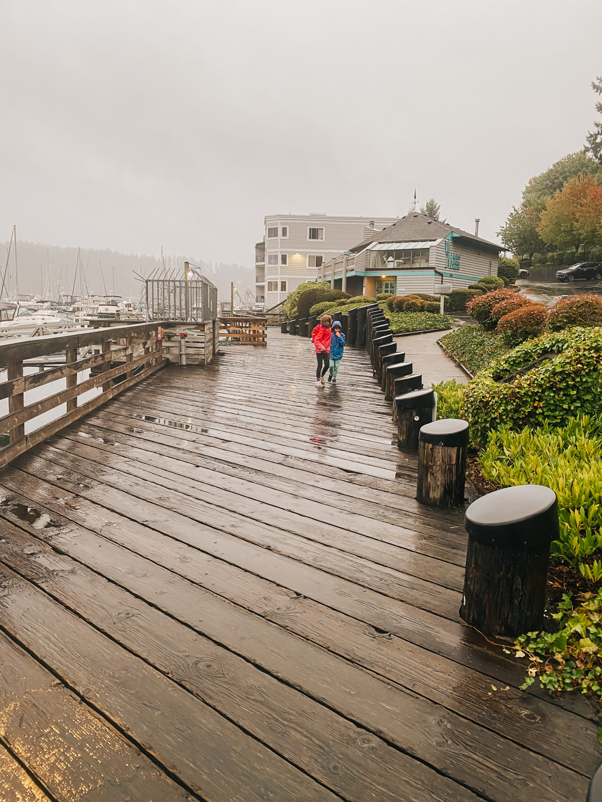
Photo by Tonya Strickland. Gig Harbor Now Columnists unite! The kids and I hang out with local history dude Greg Spadoni for a creek scouting mission in October.
Remember that time I wigged out after learning Gig Harbor’s famous Donkey Creek isn’t its real name, and that it’s not even a creek? And then I vowed to find out the origins of that naming catastrophe?
Arts & Entertainment Sponsor
Arts & Entertainment stories are made possible in part by the Gig Harbor Film Festival, a proud sponsor of Gig Harbor Now.
Well, two months after I wrote about the so-called “North Creek” stream, we did a thing.
But first, a quick recap:
The waterway in question flows south more or less alongside Burnham Drive, dips below Harborview Drive, continues its natural path around Donkey Creek Park and finally empties into the txʷaalqəł Estuary. It’s a well-told local story that this creek is named after a donkey steam engine once stationed in the creekbed circa the 1910s to pull logs from the forest and into the former Austin Mill downstream.

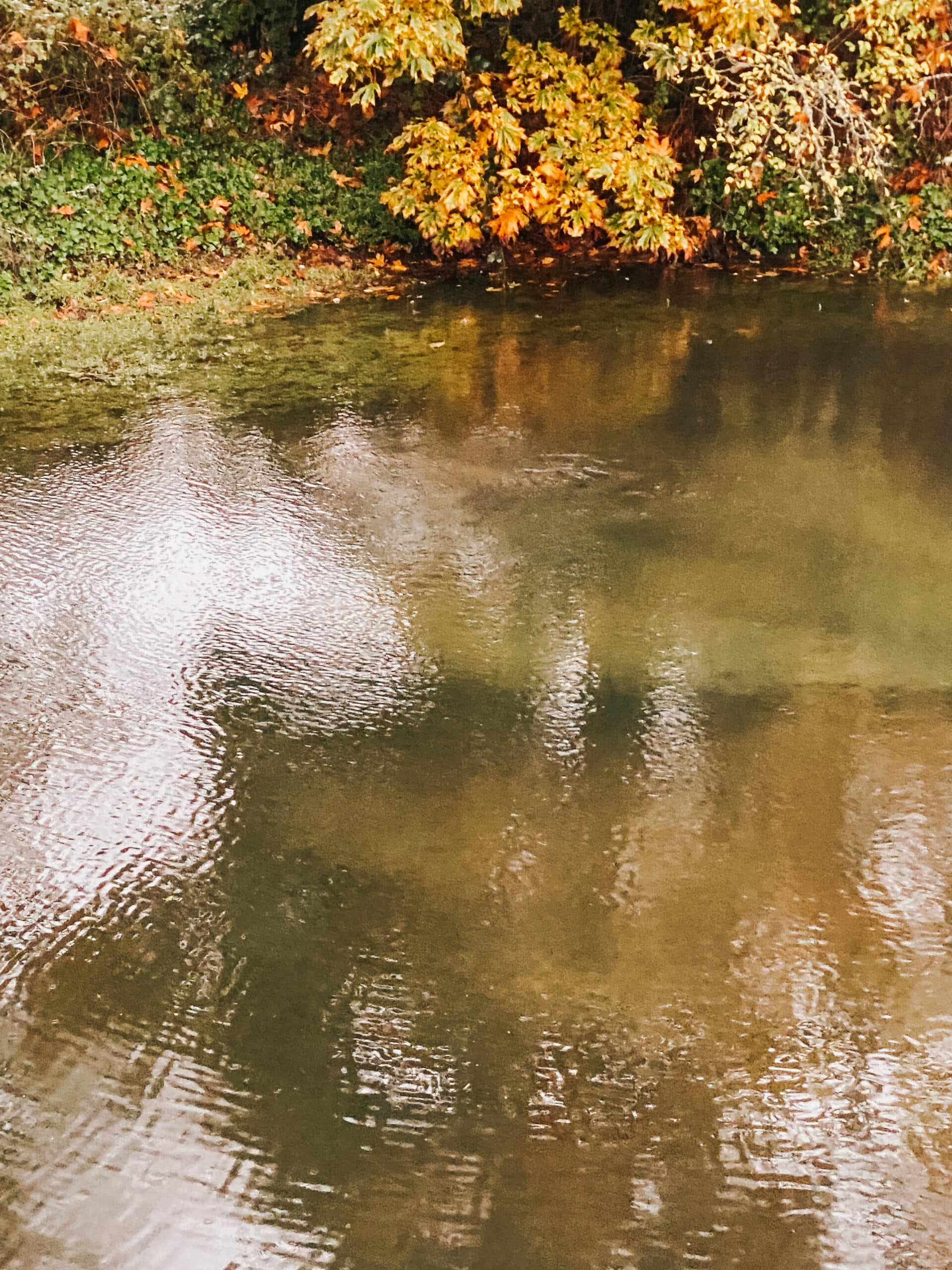
Photo by Tonya Strickland. Field trip! Greg Spadoni leads us to the last remaining signs of South Creek before it disappears underground at Harborview Drive.
Except, when you look at Google Maps, or any map going back to the 1950s for that matter, the little blue squiggle does not say Donkey Creek. It says North Creek.
That’s because North Creek is its official name according to all the federal maps and databases at the U.S. Geological Survey. In fact, the name was placed into official federal record under oversight from the U.S. Board on Geographic Names, a governmental department that gathers place data for the National Map. That map is then used as the base layer for all maps nationwide so federal, state, and local entities can call roads,waterways, landmarks, etc. by the same name to avoid mass confusion everywhere. North Creek was entered into the federal database on Sept. 10, 1979. That date, by the way, is a clue. I’ll get back to it in a minute.
A downtown field trip
Now that the recap is out of the way, let me tell you about an awesome field trip the kids and I took with local history buff Greg Spadoni of this online news organization’s very own “Gig Harbor Now and Then” column.
Naturally, I made him take a selfie with us to commemorate the occasion.
You see, Spadoni, a fellow researcher, hangs out at the Harbor History Museum’s research room quite a bit. And apparently, the Donkey Creek name drama has come up there before. Except it’s all sorts of time-consuming to pin down the origin files of how a federal place name came to be. But it sounds like a few folks before me have dabbled in the same question here and there, picked up some answers, but not all, and then life got busy — as it tends to do.
Enter little ‘ol me — a 40-something mom with next to no spare time but fascinated by basically everything — especially writing projects that involve local mysteries. Long story short, it wasn’t long before the kids and I were dragging Mr. History Columnist Extraordinaire himself out into the rain one dreary October afternoon asking him to show us everything he knew.
Clue No. 1

Photo by Tonya Strickland. The grate that whisks South Creek out of sight.
Back in August, one of my sticking points in the first creek article was that local historians and I agreed that the North Creek name was silly because it’s not even the city’s northernmost creek in that area — Crescent Creek is.
But then Spadoni told us …
“There used to also be a South Creek draining into the estuary. It might sound reasonable to presume South Creek and North Creek were named at the same time, if for no other reason than to differentiate the two.

Harborview Drive intersection with the bridge
… South Creek comes down the hill on the south side of the sewer plant, and used to enter the estuary where the parking lot of the (Harbor History) Museum is now. The museum building is where the estuary used to be. The museum sits entirely on fill. A long time ago, South Creek was rerouted underground, beginning on the sewer plant side of the street. It now runs under the parking lots of the burger shop, the Thai restaurant, and the Beach Basket, and dumps into the creek next to Murphy’s Landing Marina.
… However, if you go to the sewer plant side of the street and look at where South Creek comes down from the hill, you can see that there’s a culvert that heads across Harborview Drive towards the museum. That pipe continues all across the museum property under the parking lot, and under the museum building, and comes out in Donkey Creek, through a big T-shaped energy dissipator made of black ABS plastic, with cast iron end caps, held on by lots of steel bolts. The culvert under the museum is now just an overflow for South Creek, because the pipe in which it’s rerouted underground to Murphy’s Landing isn’t big enough to handle the flow during heavy rains.”

Photo by Tonya Strickland. The T-shaped energy dissipator rests along the banks of Donkey Creek at the estuary.
Clue No. 2
Then Spadoni found official mentions of this possibly long-forgotten “South Creek” on two old property deeds — from 1906 and 1915 — both of which included the current site of Donkey Creek Park.
Clue No. 3
Nowaways, a little blue squiggle for what appears to be South Creek can be found on some Gig Harbor maps, but not all – and it’s always unmarked. But it’s also always located directly south of its federally recognized North Creek counterpart.

Not one but TWO blue mystery squiggles appear on this online map from the USGS National Water Dashboard at usgs.gov.
So, that’s one mystery solved – the existence of South Creek is where the North Creek name came from! While I’d prefer the Donkey Creek name, I do feel a little better knowing that the “North Creek” name wasn’t thrown out willy-nilly back in the day, but was actually geographically inspired to compliment its closest riparian neighbor before she dissapeared under several tons of asphalt.
Photos by Tonya Strickland. South Creek is diverted to the marina, and comes out underwater via a pipe in the middle picture. Tip: try scouting it out at low tide! You can see it pretty well then.
Sept. 10, 1979
Solving the first part of the naming mystery brings me back to that date I mentioned earlier — Sept. 10, 1979.
If South Creek was named in an official-enough capacity to make an appearance on two property deeds dating as far back as 1906, one might think that North Creek also shared such a designation 73 years ago. So why does the USGS database say North Creek wasn’t entered until seven decades later? I wanted to know everything about this name, you guys! (I seriously looked for the USGS surveyor’s field notes). But first, I contacted their press team.

Source: USGS
The USGS Q & A
Here’s our Q and A. The answers came via email and the press contact noted that they were provided by the Board on Geographic Names staff. For reference, the green-tinted map is first USGS public map North Creek appears on for our area. The map is officially dated 1953, but then I added text to it.
Q: The North Creek entry in the USGS Geographic Names Database lists the “U.S. Geological Survey” as the name’s Originator. Could you please clarify the term ‘Originator’ as it pertains to North Creek? Was it a surveyor?
A: “This indicates that the name was collected (originated) from a U.S. Geological Survey topographic map.”
Q: Do you have any original files, maps, or documents from the surveyor who named the creek?
A: “The original files no longer exist.”
Q: Are there any alternative names listed for North Creek, (perhaps as Donkey Creek or Burnham Creek?)
A: No other names are recorded for the stream. The variant name field in the database is blank.
Q: The database mentions the North Creek name has a ‘Distribution Date’ of December 31, 1981, and an ‘Entry Date’ of September 10, 1979; but I’ve seen the name North Creek appear on the National Map dating as far back as 1953. When did the name North Creek actually become official?
A: The only information we have is that the name would have been found in local use during surveys for that 1953 map. The surveyors were not required to collect the history, just to verify the spelling and location of each name to be placed on the new map. When the geographic names database was first compiled (1978-81), all names that existed on USGS maps were collected and automatically designated as official for federal use. There was no formal vote, nor any further review of the thousands of names that were collected. Less than 5% of the names in the database have ever been the subject of formal review and approval by the U.S. Board on Geographic Names; nonetheless, all names in the database are equally official.
Q: What are the differences between the 1953, 1979 and 1981 dates?
A: 1953 is the date of the topographic map, in this case, the first 1:24,000-scale map of the area. 1979 is the date that names collection for the State of Washington was completed. 1981 is when the database was released, initially as a published gazetteer, later on CD, and now as a searchable digital file.
Q: If North Creek appeared as far back as 1953, do you have the year the creek was first named?
A: It is not known when the stream first acquired that name. That would require local research.
Q: There’s evidence here that a South Creek once existed. South Creek is not on the National Map, and it appears city or county road crews paved over it in the middle of the 1900s, which I believe dropped South Creek off the map entirely. Does the USGS have any historic records confirming the existence of a South Creek in this region?
A: There is no entry in the GNIS for a South Creek, nor does it appear on any topographic maps. We have no record of that name.
Well, shoot. I thought that South Creek solve was a done deal! I think it still is, though. My guess is Harborview Drive was paved and South Creek vanished before the 1953 USGS map came out.
Clue No. 4
When the press gal said the original naming files (from surveyors and the like) no longer exist, I wasn’t deterred for long. But that’s also why it’s taken me five months to tell you about our October scouting expedition. I wanted to find out all the things, lay them out in my update, and then close the door on North Creek for awhile. But these things are never that easy, right?

Photo by Tonya Strickland.
So Many Maps
I checked every Gig Harbor map I could find – literally hundreds – looking for the North Creek name prior to 1953. I bought old nautical charts from Goodwill; scanned Metsker’s maps, Kroll maps and Sanborn Fire Insurance Co. maps; zoomed in on every old PNW map eBay listing, discovered like 18 new websites with cool old map collections; downloaded files from the National Archives and the Library of Congress; and of course scoured all the newspaper archives. I searched everything. For months. And I found no visuals that marked North Creek (or Donkey Creek) by name around the turn of the century.
Land Survey Reports
And then, one day, when I was doing my eBay map checks over coffee while all the sane moms were listening to their favorite audiobooks or shopping online at Target, I found something. It was an antique, yellow-tinged USGS paper edition land survey report listed on eBay for $50. It wasn’t even for the Puget Sound. It was for Wisconsin or something. But it quickly made me realize that everday people have historic documents like this. Even when the federal entities don’t.
So you bet I began a new search with renewed hope for finding my creek name answers through Gig Harbor’s historic USGS surveyor reports instead of all those maps that failed me. (Except, those maps were all fantastic finds and I learned other stuff from them. Anyone need an old map recomendation?) For the survey search, I hit up all the go-to repositories, plus eBay, and even Facebook Marketplace. And did I find it?
The Cursive
Not … exactly. Lol. However, I did find some field notes. Super duper old ones. And they were taken by a government surveyor who actually stepped foot in Gig Harbor! Except … I haven’t read them all yet. Because they come in large groups of documentation, all handwritten in cursive. And not just any cursive – 1855 cursive. Eeek. Is there an app for that? 🙂
But this is a potentially big find, you guys! And I’m excited to decipher the surveyor’s fancy man text. The reports come

Pierce County Geographic Information Systems mapping tool
from the Bureau of Land Management, Land Status and Cadastral Survey Records for the Willamette Meridian (Oregon and Washington). I’ve linked them here for the two people still reading because you’ve stuck with me all this time! You’re cool. And, I know you want to take a crack at these files with me. Let me know at [email protected] what you can decode from the ancient cursive clues and I’ll share my finds, too.
NOTE: The reports are labeled in Range and Township figures – so I scooped up some coordinating numbers for our area from the mega handy Pierce County GIS mapping tool, and selecting a 1945 aerial basemap just for funsies. The numbers for Gig Harbor in general are Range: 002 and Township: 021; and the plots around Donkey Creek Park are: RTSQ No. 0221061 (Range: 02; Township: 21; Section: 06; Quarter 1); and RTSQ No. 0221064 (Range: 02; Township: 21; Section: 06; Quarter 4).
We may just figure out this mystery!

@two.n.tow
Tonya Strickland is a Gig Harbor mom-of-two and longtime journalist. Now in the travel and family niche, her blog, Two in Tow & On the Go, was recently named among the 10 Seattle-Area Instagram Accounts to Follow by ParentMap magazine. Tonya and her husband Bowen moved to Gig Harbor from California with their two kids, Clara (9) and Wyatt (7) in 2021. Find them on Facebook for all the kid-friendly places in and around town.